|
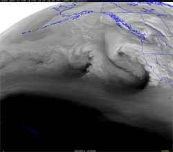

GOES-11 Water Vapor Image (UW-MAD)
January 18, 2010 - 8:30 a.m. PST
|
The first of several systems forecast to affect Southern California this week moved through the area overnight, resulting in generally moderate rainfall. Precipitation amounts in the Los Angeles area generally ranged from about 0.3 inch to 1.0 inch, with somewhat higher totals in Ventura and Santa Barbara counties. Here's an archived copy of NWS Public Information Statement with preliminary rainfall totals through 4:00 a.m. this morning.
All eyes now turn to the second system of the series, currently moving onshore. This system is expected to produce more rain, higher rain rates, stronger winds, and a higher likelihood of significant weather impacts than last night's system.
Please refer to www.weather.gov/losangeles for the latest information.
|