|
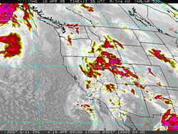

GOES-11 IR Image
Friday, April 10, 2009 6:30 a.m. PDT
|
Upper low off the coast of Southern California this morning is forecast to track into Northern Baja by Saturday, and then continue east into Texas Easter Sunday. There's a chance of a shower, or possibly a thunderstorm, over much of Southern California today, diminishing tonight. Tomorrow is expected to be partly cloudy, with mostly sunny skies forecast for Easter Sunday.
Downtown Los Angeles (USC) recorded at total of 0.03 inch of rain Tuesday into Wednesday as a weak front associated with an upper level low moved through the basin. The rainfall increased the water year precipitation total for Los Angeles to 8.93 inches, which is about 5.5 inches below normal. Here is an archived copy of a NWS Public Information Statement, with some precipitation totals from around the area.
|