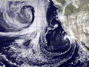

NRL GOES-15 Visible/IR Satellite Image
Sunday, March 25, 2012 at 1:31 pm PDT
Low pressure "alow and aloft" and associated surface boundaries resulted in some higher than expected rainfall totals Sunday. Gauges in the Santa Monica Mountains generally recorded from 2-3 inches of rain, Valleys and the Metro area 1-2 inches, and Los Angeles County mountains 1-2.5 inches. Here are some preliminary rainfall totals from around the area compiled by the NWS, and a snapshot of a Ventura County Watershed Protection District Google Map with some additional rainfall totals.
Downtown Los Angeles (USC) recorded 0.95 inch for the storm, bringing the 2011-2012 water year total to 6.93 inches. This boosts the water year total to 51% of normal. The wet weather the last two weekends makes March the wettest month of the rain season to date at Los Angeles. It may have taken the edge off a very dry rain season for the moment, but rainfall totals the past 30 days have still been below normal in much of Southern California and additional rainfall would really help.
The good news is it looks like the current progressive pattern of West Coast troughs will continue into April. While at the moment it appears the next trough in the series won't produce more than a smattering of rain south of Pt. Conception, the ECMWF has been relatively consistent in bringing in a system similar to our last storm weekend after next. That's a long way out, and the GFS and GEFS don't agree with the ECMWF, but we'll see!
Update 04/02/12. Saturday's system produced a little more rain than expected south of Pt. Conception. Downtown Los Angeles (USC) recorded 0.04 inch for the storm, bringing the 2011-2012 water year total to 6.97 inches. Here are some rainfall totals from around the area compiled by the NWS. At the moment it looks like a disturbance rotating around a large Gulf of Alaska low will probably not elongate and deepen the low enough to produce rain in Southern California, but will result in cooler temperatures Wednesday and Thursday. Higher pressure is forecast to build in behind the trough, with a warming trend forecast through Easter weekend.
According to the Australian Bureau of Meteorology ENSO Wrap-up, issued March 27, the 2011–12 La Niña event has ended, with key indicators returning to neutral levels.
The IRI/CPC mid-March plume of forecasts made by dynamical and statistical models for SST in the Nino 3.4 region suggest ENSO Neutral conditions will persist through boreal autumn 2012. However, as climatologist Klaus Wolter points out, all ten of the two-year La Niña events between 1900 and 2009 either continued as a La Niña event for a third year (four of ten), or switched to El Niño (six of ten), with none of them becoming ENSO-neutral.
More information about Southern California weather and climate can be found using our WEATHER LINKS page.