|
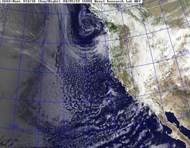

NRL Day/Night Visible Satellite Image
April 4, 2010 - 9:00 a.m. PDT
|
This week's Pacific system produced more rain in Southern California than recent similar troughs. The front associated with the system stalled as it approached the Los Angeles basin, and the low level inflow and jet dynamics helped sustain rain rates as the front dissipated.
Downtown Los Angeles (USC) recorded 0.60 inch of rain, bringing the water year total to 15.26 inches, which is above the 1971-2000 annual climate norm of 15.14 inches*. Here's an archived copy of a NWS Public Information Statement with some rainfall totals from around the area.
The water year ends June 30, so we still have a few weeks to add to our rainfall total. Los Angeles rainfall was below normal for the month of March, but we're already above normal month to date for April and it looks like more wet weather could be on the way. Recent runs of the GFS and ECMWF have been suggesting another system will affect Southern California the Sunday evening to Monday timeframe, and also project the possibility of another system midweek. We'll see!
|
|
More information concerning Southern California weather can be found using our WEATHER LINKS page.
*The average annual rainfall for Los Angeles of 15.14 inches is computed on a calendar year basis for the 30 year period 1971-2000. Technically it is not a water year average, but by convention it is used as a reference for water year rainfall. For details about how normal temperature and precipitation values are computed, see CLIMATOGRAPHY OF THE U.S. NO. 81 - Monthly Station Normals.
|