|
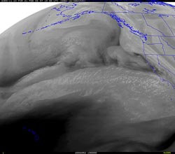

UW GOES-11 Water Vapor
February 21, 2008 11:00 am PST.
|
Precipitation totals from the first of a series of shortwaves associated with a extended Pacific jetstream produced rainfall amounts ranging from about 0.1 to 0.25 inch in the Los Angeles area yesterday, with up to about 0.5 inch recorded in some mountain locations.
Downtown Los Angeles (USC- KCQT) recorded 0.14 inches of rain Wednesday, bringing the water year total (since July 1) to 12.27 inches -- still about 2.5 inches above normal for the date. Here is an archived PDF of a NWS Public Information Statement with some preliminary rainfall totals as of 4:00 p.m. yesterday afternoon.
There were a few sprinkles this morning, and Intellicast composite radar shows some shower activity around the area at 12:30 p.m. this afternoon. More general rain is expected to develop this afternoon or evening. Today's 12z NAM projects about 0.6 inch at Los Angeles between now and mid-morning Friday. Over that same period, a BUFKIT analysis of 12z NAM data for Van Nuys projects about 0.75 inch, but an analysis of 12z GFS data generates only about 0.25 inch.
|
|
A third system is forecast for the Saturday afternoon into Sunday timeframe and is expected to produce similar amounts of precipitation. However, the upper level flow will be transitioning to a more amplified pattern, so the computer models may have some difficulty with the forecast. We'll see!
Following this series of systems, a ridge is forecast to build in, resulting in generally fair, Spring-like weather for at least several days. Today's NWS 6-10 Day and 8-14 Day Precipitation Outlooks for Southern California are indicating Below Normal precipitation.
More information concerning Southern California weather can be found using our WEATHER LINKS page.
|