|
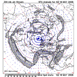

SFSU 300mb Jetstream Analysis - 5/16/08 12z
|
Chance of a Shower Next Weekend?
An unseasonably strong and extended Pacific jetstream has resulted in a very high amplitude high pressure ridge over the West Coast with record and near record temperatures seen from Seattle to San Diego.
Yesterday, Woodland Hills set a new high temperature record for the date of 101°F. Record high temperatures were also recorded at Ojai, Sandberg, Santa Ana, El Cajon, Red Bluff, Redding, Sacramento, Stockton, Modesto, San Jose, Eureka and several other stations in California. Triple digit highs were recorded across much of the interior of the state.
|
|
It's hot again today, and will be hot again tomorrow, but the GFS, ECMWF and other guidance is suggesting that as the extended Pacific jet collapses, the west coast ridge will retrograde off the coast and be replaced by a trough by Memorial Day Weekend. This would result in cooler weather in California, and even the possibility of showers in some areas, such as the Sierra and our local mountains. We'll see!
More information concerning Southern California weather can be found using our WEATHER LINKS page.
|