
HPC Forecast Precipitation
For the 2-Day Period Ending 4:00 p.m. Sunday.
Thanks to October's unusual amount of rainfall, precipitation totals for many areas of Southern California remain near or above normal for the 2010-11 water year. But November has been relatively dry, and Downtown Los Angeles (USC) is now about 0.30 inch below normal for the month, and for the water year. That's expected to change over the weekend.
A series of impulses on the downstream side of a high amplitude upper ridge is forecast to amplify a trough and generate an energetic upper low along the coast of the western U.S. tonight.
The 00z NAM/WRF shows a strong front moving down the coast and through Southern California on Saturday, a second impulse on Sunday, and possibly a third on Monday.
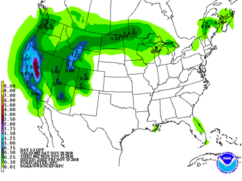
BUFKIT analysis of this evening's 00z NAM data for Van Nuys project rainfall totals of about an inch over the 24 hr. period ending Saturday at 4:00 p.m., and then another third of an inch or so Sunday. The 00z GFS isn't as generous with the rainfall amounts, generating about 0.5 inch on Saturday and 0.3 inch on Sunday, but appears too fast when compared to current satellite and radar images.
SREF means & spreads suggest amounts across the area should generally range from about 0.5 inch to 1.25 inches, with more expected in the mountains. We'll see!
More information concerning Southern California weather can be found using our WEATHER LINKS page.