
WSI Intellicast.com Composite Radar Image
Friday, April 13, 2012 at 11:00 am PDT
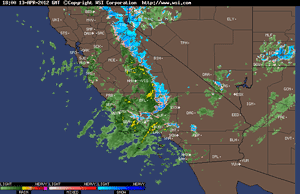
Some of the video of yesterday's rainstorm looked more like coverage of a hurricane rather than an April storm in Los Angeles. There were flooded streets and creeks, lightning strikes of aircraft and gas lines, strong winds, waterspouts, hail, toppled trees, mountain snow and more. Downtown Los Angeles (USC) set a new rainfall record for the date of 0.49 inches, breaking a record set in 1956.
The system's strong dynamics were due in part to upper level divergence associated with an ideally positioned jet max and strong positive vorticity advection. The result was strong omega, with 12z NAM vertical velocities at KVNY on the order of -25 microbars per second from 900 mb to 600 mb.
Apirl's above average rainfall has increased the water year (July 1 to June 30) rainfall total for Downtown Los Angeles to 8.19 inches, which is about 58% of normal. Here are some preliminary rainfall totals from around the area for the storm earlier in the week and yesterday's storm compiled by the NWS, and a snapshot of a Ventura County Watershed Protection District Google Map (large image) with some rainfall totals for the past week.
More information about Southern California weather and climate can be found using our WEATHER LINKS page.