|
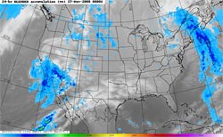

NRL NEXSAT 24 hr. Blended Precipitation)
Period Ending 11/26/08 - 4:00 p.m. PST
|
Happy Thanksgiving! Our record-setting upper low system is slowly moving east out of the area, but this morning there's still some shower activity occurring south and east of the Los Angeles basin. The best chance of showers today is in the mountains, and areas south and east of the basin, but a shower could pop up just about anywhere in Southern California.
Rainfall totals for the storm have generally ranged from 1.0 to 2.0 inches in the coastal and valley areas, with some higher amounts recorded in foothill and mountain locations. Rainfall records for November 26th were broken at several locations, including Lancaster, Palmdale, Sandberg, UCLA, Burbank, Woodland Hills, and San Gabriel. OPIDS Camp, in the San Gabriel Mountains has recorded 3.29 inches. Here are some preliminary rainfall totals from the NWS.
|
|
Through yesterday, Downtown Los Angeles (USC) has recorded a storm total of 1.60 inches, bringing the water year total to 1.87 inches, which is 0.17 inches above normal for the date.
More information concerning Southern California weather can be found using our WEATHER LINKS page.
|