|
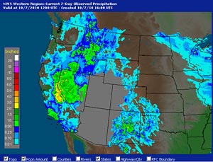

AHPS Precipitation Totals
For the 7-day Period Ending 10/07/10 12z
|
Just a week after Downtown Los Angeles (USC) set a new all time temperature record of 113°F, an unseasonably strong cutoff upper level low set up shop over Southern California, cooling temperatures and producing record rainfall over much of the area. Precipitation was recorded in many locations Monday and Tuesday, but Wednesday was the record setting day.
According to the NWS Los Angeles/Oxnard, rainfall records for the date were set at numerous locations. Downtown Los Angeles (USC) recorded 0.30 inch, breaking the record of 0.22 inch back in 1916. Just a few miles away, LAX recorded 0.62 inch, smashing the old record of 0.16 set in 1945. Here's a preliminary record report (PDF) from the NWS.
Cumulative rainfall totals recorded over the three days varied widely, ranging from 0.10 inch in Lancaster to over 2.0 inches at some locations in Ventura county. Downtown Los Angeles (USC) recorded 0.40 inch for the storm. This is slightly above the October monthly norm, but because July, August and September had no measurable rain, Los Angeles remains 0.12 inch below normal for the water year. Here is a Public Information Statement (PDF) from the NWS with some rainfall totals from around the area.
|