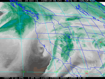

GOES-11 Water Vapor Image
Sunday, November 20, 2011 - 11:30 am PST
For the past two years Los Angeles has recorded above normal rainfall over the first six months of the water year (Jul. 1 to Dec. 31). So far this year is following suit.
After a record-setting storm in early October in which Downtown Los Angeles (USC) recorded over an inch or rain, a series of upper level troughs have continued to bump up the rainfall total. The systems have tended to be amplifying upper level troughs that split, typically transforming the southern half of the trough into a difficult-to-forecast cut-off upper level low. The resulting cut-off lows have then tracked over, along, or off the Southern California coast producing varying amounts of rain.
Sunday's system was the fourth to produce measurable rain in Los Angeles this November. A strong cold front produced very heavy rain, resulting in flooded streets and highways and resulting in a host of other weather-related problems. In the middle of it all runners in the PCTR Santa Monica Mountains 9K, 18K, 30K and 50K were running distances up to 31.5 miles on the trails of Pt. Mugu State Park.
Downtown Los Angeles (USC) recorded 0.90 inches for the storm, bringing the water year total to 2.75 inches. This is 1.11 inch above the new 1981-2010 normal for rainfall from July 1 through November 22. Here are some additional (preliminary) precipitation totals from around the area, compiled by the NWS Los Angeles/Oxnard. More than an inch above normal sounds like a lot, but as of today only guarantees Los Angeles precipitation will be above normal through December 12.
Back on July 1 NOAA released the new 1981-2010 climate normals, replacing the 1971-2000 normals that have been used this past decade. Normals serve as a 30 year baseline average of climate variables such as monthly and annual maximum, minimum, and mean temperature; and monthly and annual total precipitation. For example, Downtown Los Angeles' new normal annual precipitation total is now 14.93 inches, down from the 15.14 inches we've been using.
After dropping to -0.503 for July/August, and then to -0.772 for August/September, the September/October value of the Multivariate ENSO Index (MEI) has dropped a bit more to -.968 sigma. This is well within La Nina territory, but almost one sigma less than last year's September/October value. Plots of the Global Wind Oscillation (GWO) for July 1 to November 19, 2011 and the same period last year illustrate the year-to-year difference in the atmosphere's response to La Nina conditions. So far, this year's response is consistent with a more active MJO and a shift toward a more neutral ENSO state.
While there's still a chance of rain in Southern California Thanksgiving Day, the forecast is looking better than it did a few days ago when rain was considered likely. The difficulty in the forecast is yet another upper level trough splitting into a cut-off upper level low. The 12z NAM forecasts the low to remain offshore on Thanksgiving Day, and move into Northern Baja by the late afternoon. The 09z SREF puts the probability of more than 0.01 inch of rain in coastal Southern California for the 12 hours ending 4:00 pm Thursday at 10% - 30% and the chance of more than 0.10 inch of rain at around 10%. A shift in the track of the low toward the coast would significantly increase the chance of rain. We'll see!
More information about Southern California weather and climate can be found using our WEATHER LINKS page.