
NOTES ABOUT SOUTHERN CALIFORNIA WEATHER & CLIMATE
© 2000-2024 Gary Valle'. All Rights Reserved.
|
NOTES ABOUT SOUTHERN CALIFORNIA WEATHER & CLIMATE © 2000-2024 Gary Valle'. All Rights Reserved. |
IMPORTANT!! The
information presented on this web site may include errors of transcription,
interpretation, and other errors. The information may be out of date or
inaccurate. Please refer to the NATIONAL WEATHER SERVICE FORECAST OFFICE
LOS ANGELES or your local weather service office for official
forecasts and warnings. |
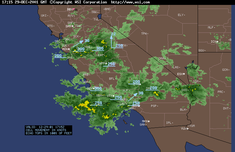 Intellicast Radar Summary 12/29/01 1715z |
Weathernotes for Saturday, December 29, 2001Intellicast Radar Summary from 9:15 this morning shows moisture streaming across Southern California with a band of stronger echoes offshore. Rainfall totals in Santa Barbara and Ventura county have generally been about 0.1 to 0.3 inches with 0.5 inch or higher recorded in a few locations. Rainfall amounts have been less in Los Angeles county, ranging from 0.05 to about 0.15 inch. (The band of heavier precipitation moved onshore between Ventura and Los Angeles and resulted in about 0.25" of additional rainfall in some areas.) |
|
In the last 24 hours or so, the heaviest precipitation has been in the Sierra Nevada. Snow levels are high. This morning's sounding at Vandenberg Air Force base recorded a freezing level of over 11,000 ft., with a "wet bulb zero" of about 10,000 ft. Snow sensors in the Southern Sierra suggest mixed rain and snow at 9000 ft. Mammoth Mountain is reporting 12 inches of new snow in the last 24 hours. Today's CPC/NCEP Outlooks depicted "Below Normal" precipitation for the 6-10 day period and "Below Normal" for the 8-14 day period for Southern California. More information concerning Southern California weather can be found using our WEATHER LINKS page. |
|
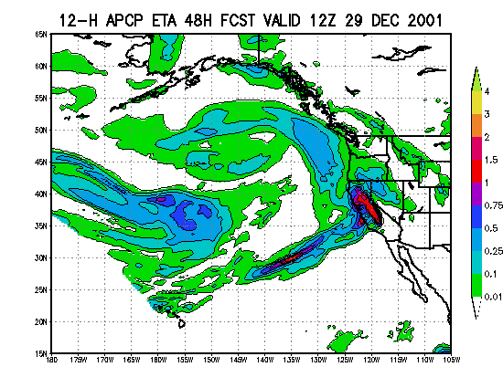 12/27 12z ETA-12 12 hr. Precipitation Ending 12/29/01 12z |
Weathernotes for Thursday, December 27, 2001Normally two things are required to produce precipitation: moisture and some kind of lifting mechanism. Over the next few days there are several periods when the atmosphere is forecast to be quite moist over the Los Angeles area, but with almost no dynamics present to lift the air mass and produce rain. To our north, somewhat better dynamics and the orographic lift of the coastal mountains and the Sierra Nevada are expected to produce heavy mountain precipitation. |
|
The mid-latitude systems and associated tropical moisture may result in a rain on snow event in the Sierra. Orographic enhancement of rainfall and snow levels in excess of 7000 to 9000 ft. could produce significant runoff and some erosion of the Sierra snowpack. While the bulk of precipitation is currently forecast to occur north of the Los Angeles basin, shifts in the axis of the moist southwesterly flow or embedded waves, vorticity, or jet dynamics could change the rainfall pattern. Today's CPC/NCEP Outlooks depicted "Below Normal" precipitation for the 6-10 day period and "Below Normal" for the 8-14 day period for Southern California. More information concerning Southern California weather can be found using our WEATHER LINKS page. |
|
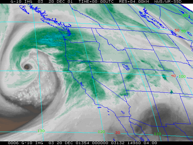 GOES-10 Water Vapor 12/20/01 00z (4 PM PST) |
Weathernotes for Wednesday, December 19, 2001Impressive looking, tightly wound low pressure system moving into the West Coast this evening. Models move the low and associated vorticity down the coast and through Southern California Thursday afternoon and evening. The upper low is expected to move through the area relatively quickly, and precipitable water values are not expected to be high, BUT there is the potential for some significant isolated convection induced rainfall. Isolated thunderstorms are possible. |
|
Today's CPC/NCEP Outlooks depicted "Below Normal" precipitation for the 6-10 day period and "Below Normal" for the 8-14 day period for Southern California. More information concerning Southern California weather can be found using our WEATHER LINKS page. |
|
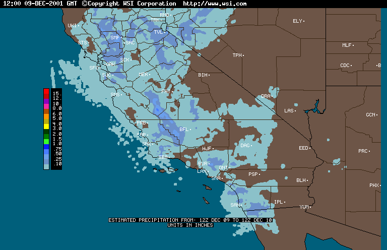 Intellicast Radar 24 Hr. Precipitation Estimate |
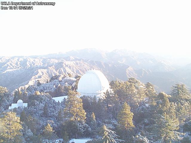
Weathernotes for Monday, December 10, 2001An energetic, but moisture-starved, upper low and associated vortex max churned down the state like an atmospheric street sweeper yesterday, producing towering clouds and and leaving a swath of moisture in its wake. You wouldn't have thought the system was lacking moisture if you happened to be in the area of one of the heavier downpours. A few stations reported more than 0.5 inch of rain, but many gauges recorded no precipitation at all. |
|
This morning, Mammoth Mountain is reporting 6 inches of new snow, and the UCLA Dept. of Astronomy Mt. Wilson webcam shows a little new snow in the San Gabriels. A strong (~1036mb) high at the surface and aloft in the eastern Pacific is dominating West Coast weather, forcing Pacific systems up and over the high, and then down the backside into the Northwest and the western states. This pattern typically results in cold, blustery weather in Southern California, with below normal precipitation. Ensemble forecasts suggest this ridge will persist for at least another week, perhaps flattening somewhat next week. Medium range models currently show another inside slider moving through Northern California in the Thursday-Friday timeframe and this could result in some more showers in our area around Friday, with a somewhat better chance of measurable precipitation in the mountains north of the L.A. basin. Today's CPC/NCEP Outlooks depicted "Below Normal" precipitation for the 6-10 day period and "Normal" for the 8-14 day period for Southern California. More information concerning Southern California weather can be found using our WEATHER LINKS page. |
|
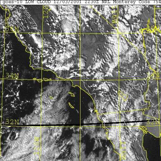 GOES-10 IR 11/29/01 1430z |
Weathernotes for Monday, December 3, 2001This afternoon there are some isolated build-ups around the Southland, as the axis of a deep trough moves onshore to our north, but digs further south at the base. Radar shows some fairly strong echoes in the vicinity of these build-ups. Generally skies are partly cloudy, but as satellite and radar data attest, there is a continued chance of showers or thunderstorms this afternoon and evening, diminishing overnight. This system wasn't a big rain producer in the L.A. area. Amounts ranged from about a 0.10-0.25 inch in Downtown and Valley locations to about 0.75 inch at Mt. Wilson. Amounts were generally higher from Santa Barbara northward. |
|
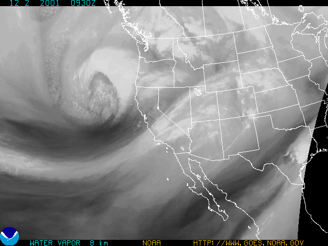
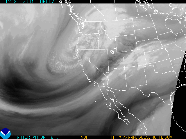
The real story is the heavy snowfall in the higher elevations of the Sierra. This morning Mammoth Mountain was reporting 36 inches of new snow over the weekend, and snow sensors up and down the range were reporting similar amounts. Today's Summary of Snow Water Equivalents (provided by California Cooperative Snow Surveys) reported 155% of normal for the date in the Northern Sierra, 168% in the Central Sierra, and 190% in the Southern Sierra. Water vapor satellite photos from Saturday evening and Sunday evening show the west to southwesterly flow necessary for orographically enhanced snowfall in the Sierra. Today's CPC/NCEP Outlooks depicted "Below Normal" precipitation for the 6-10 day period and "Below Normal" for the 8-14 day period for Southern California. More information concerning Southern California weather can be found using our WEATHER LINKS page. |
|
