
NOTES ABOUT SOUTHERN CALIFORNIA WEATHER & CLIMATE
© 2000-2024 Gary Valle'. All Rights Reserved.
|
NOTES ABOUT SOUTHERN CALIFORNIA WEATHER & CLIMATE © 2000-2024 Gary Valle'. All Rights Reserved. |
IMPORTANT!! The
information presented on this web site may include errors of transcription,
interpretation, and other errors. The information may be out of date or
inaccurate. Please refer to the NATIONAL WEATHER SERVICE FORECAST OFFICE
LOS ANGELES or your local weather service office for official
forecasts and warnings. |

WSI Intellicast Precipitation Estimate for 24 hrs Ending 12z 11/09/02 |
Weathernotes for Saturday, November 9, 2002From Thursday afternoon overnight to Friday morning, my rain gauge near the Simi Hills recorded 1.35 inches. That doesn't sound like a huge amount, but that's more precipitation than the total recorded for the previous 10 months. So far the storm total for this gauge has been a little over two inches. Generally, 1 to 2 inches of rain have fallen in the lowland areas of Los Angeles, with higher amounts in orographically favored foothill and mountain locations. Los Angeles (USC) set a new record Friday with 1.82 inches of precipitation. |
|
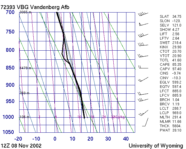
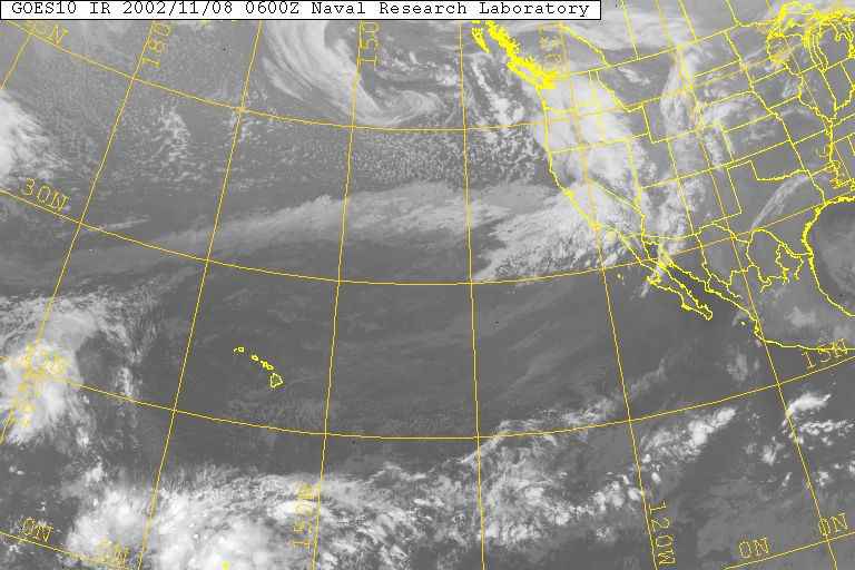
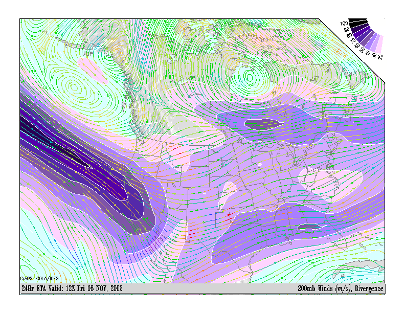
To our north, in Ventura, Santa Barbara, San Luis Obispo, and Kern counties, rainfall amounts have been significantly higher, with 4 to 5 inch readings fairly common. Some favored locations have recorded substantially more. La Cumbre Peak, above Santa Barbara, has recorded nearly 15 inches of rain! This WSI Intellicast radar based estimate provides a good idea of the rainfall distribution for the 24 hour period ending 12z (4:00 a.m.) this morning. This 12z sounding from Vandenberg AFB shows the strength and favorable direction of the inflow along the coast. The precipitable water value for this sounding was about 1.5 inches. The system was characterized by a strong 150+ kt. jetstream and associated exit region dynamics and a deep, moist southwesterly to westerly flow. With all the rain the closure orders for National Forests in the area have been rescinded, but fire restrictions remain in place. More information concerning Southern California weather can be found using our WEATHER LINKS page. |
|
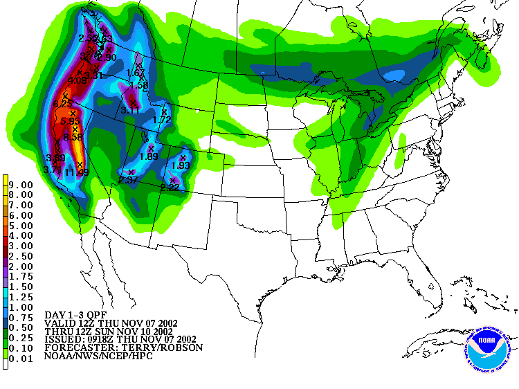
HPC QPF Forecast for Next 3 Days - 11/07/02 |
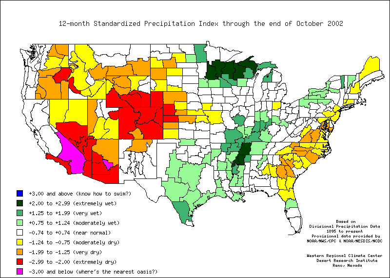
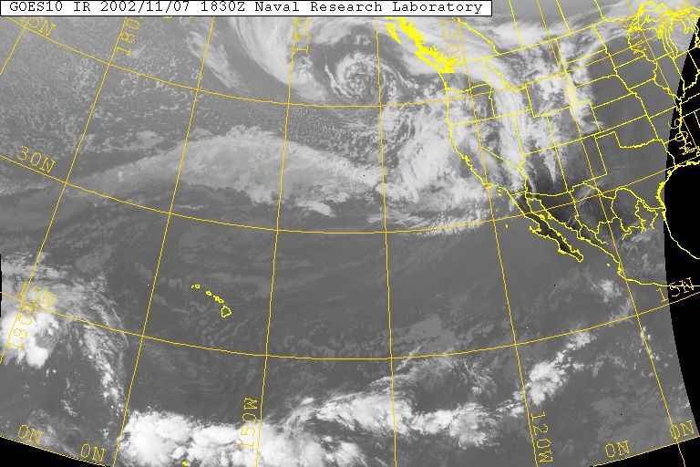
Weathernotes for Thursday, November 7, 2002The rain gauge at my house, northwest of Los Angeles, has recorded 1.26 inches of rain since January 1, 2002. A nearby RAWS station in the Simi Hills has recorded a nearly identical total. The water year ending June 30 was the driest Los Angeles has experienced since record-keeping began in 1877. Angeles National Forest is closed due to extremely dry conditions and the resultant fire danger. Large areas of the western U.S. are experiencing drought conditions. |
|
A very energetic Pacific system, the first in a potentially El Nino enhanced rainy season, should bring some rain, and relief, to much of the West. In California, very heavy rain and snow is forecast over the northern two-thirds of the state. The HPC 72 hour quantitative precipitation forecast issued this morning shows over 7 inches of precipitation at the higher elevations of the Sierra, with as much as 11 inches (liquid equivalent) forecast in the south-central Sierra. Closer to home precipitation amounts are expected to be lower than to the north. Forecast QPFs have been trending to somewhat higher amounts as subsequent model runs position the strong jet and its dynamics a little more to the south. The CNRFC 3-day QPF forecast issued 11/07/02 at 1604Z forecasts about 2.0 inches at San Marcos Pass, 0.8 inch at the Civic Center, and 1.5 inches at OPIDS Camp near Mt. Wilson. A BUFKIT analysis of 00z ETA data for Van Nuys produces about 0.75 inches of rain through 12z (4:00 AM) Saturday morning. More information concerning Southern California weather can be found using our WEATHER LINKS page. |
|
