
NOTES ABOUT SOUTHERN CALIFORNIA WEATHER & CLIMATE
© 2000-2024 Gary Valle'. All Rights Reserved.
|
NOTES ABOUT SOUTHERN CALIFORNIA WEATHER & CLIMATE © 2000-2024 Gary Valle'. All Rights Reserved. |
IMPORTANT!! The
information presented on this web site may include errors of transcription,
interpretation, and other errors. The information may be out of date or
inaccurate. Please refer to the NATIONAL WEATHER SERVICE FORECAST OFFICE
LOS ANGELES or your local weather service office for official
forecasts and warnings. |
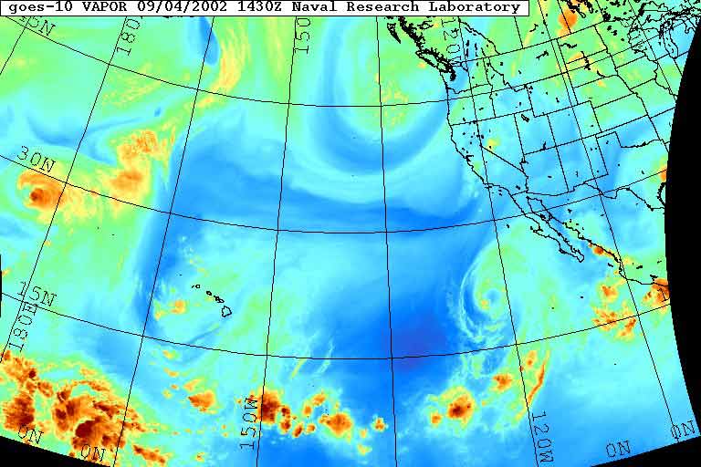 NRL GOES-10 Water Vapor 09/04/02 1430z |
Weathernotes for Wednesday, September 4, 2002In September it's not uncommon for an Eastern Pacific hurricane to work it's way north from the warm waters off Baja, weaken in the cooler waters and dissipate. But it is somewhat unusual to have a 558mb upper low and trough work its way down from the Pacific Northwest and interact with a dissipating hurricane. |
|
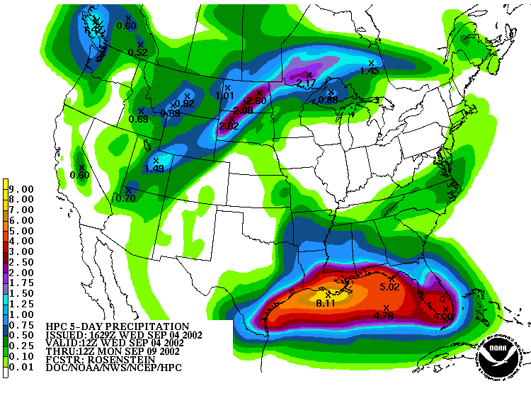
This GOES-10 Water Vapor photo from NRL shows the U-shaped trough digging south, as well as Hurricane Hernan moving north. How these two elements interact over the next few days could dramatically affect the weather in Central and Southern California. Scattered light showers are already occurring in the San Joaquin Valley and more precipitation is expected. Where, when, and how much are the big questions. At the moment model data suggests the possibility of significant rain in the Central and Southern Sierra, as well as the mountains of Santa Barbara and San Luis Opisbo Counties. But, there is a lot of uncertainty and the amount and focus of any precipitation could change. Higher humidity and rainfall could help with the fight against ongoing brush fires in Southern and Central California, but too much rain might cause run-off and erosion problems in areas that have already been burned. This morning's HPC 5-day precipitation forecast has a maximum pf 0.6 inch in the Central Sierra, with no measurable rain forecast for the L.A. area. We'll see! More information concerning Southern California weather can be found using our WEATHER LINKS page. |
|
