
NOTES ABOUT SOUTHERN CALIFORNIA WEATHER & CLIMATE
© 2000-2024 Gary Valle'. All Rights Reserved.
|
NOTES ABOUT SOUTHERN CALIFORNIA WEATHER & CLIMATE © 2000-2024 Gary Valle'. All Rights Reserved. |
IMPORTANT!! The
information presented on this web site may include errors of transcription,
interpretation, and other errors. The information may be out of date or
inaccurate. Please refer to the NATIONAL WEATHER SERVICE FORECAST OFFICE
LOS ANGELES or your local weather service office for official
forecasts and warnings. |
Previous Month - Index - Next
|
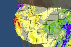
El Niño False Alarm? Drier than average weather in the Southwestern U.S., and wet weather in the Pacific Northwest in recent weeks has some folks wondering if the 2009-2010 El Niño is going to be another one of the quirky, underachieving El Niños we've been seeing this decade. |
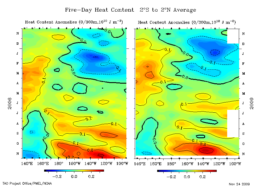
For much of September and October, the primary area of equatorial convection in the Eastern Hemisphere was in the Central Pacific, just west of the dateline. Convection was suppressed in the Indian Ocean. Such a pattern is consistent with El Niño. Enhanced convection centered at about 160E in early October may have helped to extend the Pacific jet following an East Asian mountain torque event around October 5. This in turn may have contributed to an atmospheric river precipitation event in California October 13-14, 2009. At that time it looked like we might finally be off and running with a "real" El Niño event. Particularly because during October equatorial Pacific SSTs and heat content anomalies increased dramatically. Theses increases were the result of of a strong Westerly Wind Burst (WWB), an associated downwelling Kelvin wave, and diminished tradewinds, However -- and I think I hear Ed Berry's Rottweiler growling -- beginning in mid October, strong convection developed in the Indian Ocean. This essentially neutralized El Niño, and perhaps contributed to the La Nina like precipitation pattern we've been experiencing along the west coast of the U.S. Indicative of the ocean-atmosphere issues, relative Atmospheric Angular Momentum (AAM) has been negative since early September, and the Global Wind Oscillation (GWO) has remained on the La Nina side of the GWO phase space. Does this mean we've had an El Niño false alarm? I wouldn't put away my rain gear just yet. Although November rainfall for Downtown Los Angeles is about 0.6 inch below normal, we usually only get about an inch of rain in November. And don't forget, because of the big storm in October, we are still about 0.6 inch ABOVE normal rainfall for the water year. Update November 24, 2009. Current equatorial heat content anomalies are about the same as in 2006, not greater. See this composite TAO/TRITON section plot comparing equatorial heat content in 2006 and 2009. And there are some positive signs. Equatorial Pacific SST and heat content anomalies are much greater than in the short-lived 2006 El Niño, and are more along the lines of those observed in the 2002-2003 El Niño. In addition, a strong MJO has developed. It has remained coherent, and is propagating eastward into the Western Pacific. It already appears to be helping to enhance convection in the Western and Central Pacific, and could kick-start the El Niño engine over the next week or two. We'll see! More information concerning Southern
California weather can be found using our WEATHER
LINKS page. |
|
or Press your Browser's BACK button.
