
NOTES ABOUT SOUTHERN CALIFORNIA WEATHER & CLIMATE
© 2000-2024 Gary Valle'. All Rights Reserved.
|
NOTES ABOUT SOUTHERN CALIFORNIA WEATHER & CLIMATE © 2000-2024 Gary Valle'. All Rights Reserved. |
IMPORTANT!! The
information presented on this web site may include errors of transcription,
interpretation, and other errors. The information may be out of date or
inaccurate. Please refer to the NATIONAL WEATHER SERVICE FORECAST OFFICE
LOS ANGELES or your local weather service office for official
forecasts and warnings. |
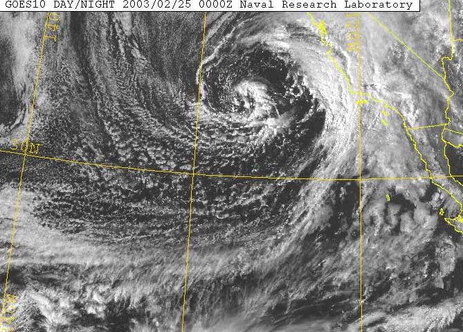
NRL GOES-10 VIS 02/25/03 0000z ( 02/24 4;00 pm) |
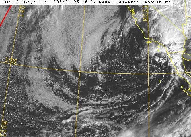
Weathernotes for Wednesday, February 26, 2003This visible satellite photo from the Naval Research Laboratory shows the position and circulation of our latest storm on Monday afternoon at 4:00. Sixteen-plus hours later the low center had moved to just off the coast, near San Diego. |
|
With the exception of some orographically favored mountain and foothill areas, this track resulted in the best dynamics and heaviest precipitation generally occurring south of the L.A. basin. Rainfall amounts downtown and in the valleys generally ranged from about 0.25 to 0.75 inches with higher amounts in the mountains. South of Los Angeles precipitation amounts were more frequently in the 1.0 to 2.0 inch range. Since July 1, the recorded rainfall in downtown Los Angeles (USC) is just 0.24 inch below normal. Unsettled weather with variable clouds and a chance of a shower is expected into the weekend. The current 6-10 day, 8-14 day, and week 2 forecasts suggest the possibility of more showers or rain over the next two weeks. More information concerning Southern California weather can be found using our WEATHER LINKS page. |
|
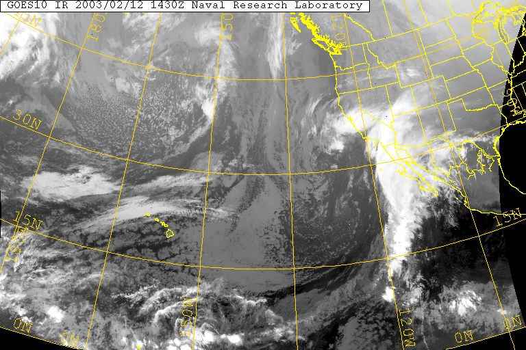
GOES-10 IR 02/12/03 1430z (6:30 am) |
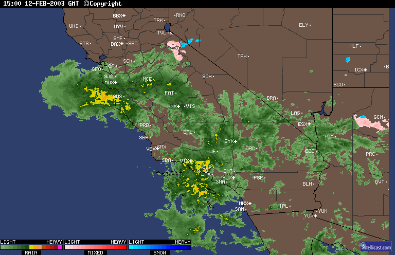
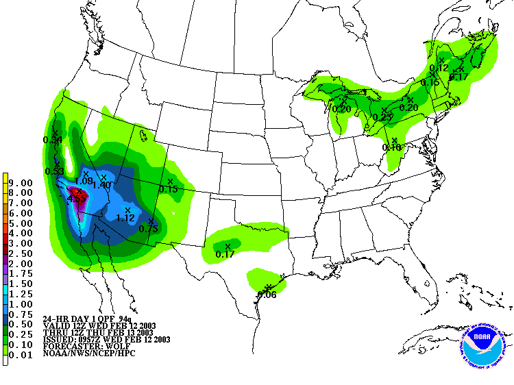
Weathernotes for Wednesday, February 12, 2003Following one of the driest and warmest Januarys on record, a vigorous upper low spinning off the Southern California coast has tapped into tropical moisture and is producing widespread precipitation over much of the Southwest with heavy rainfall in several areas of Southern California. |
|
As of noon, preliminary rainfall amounts for the storm have generally ranged from 2.0 to 4.0 inches with 4 inch amounts common in the San Fernando Valley, and some foothill and mountain locations. The precipitation record for Downtown Los Angeles for this date is 2.3 inches. This was recorded in 2001. So far today this station has recorded about half of this amount , but more heavy rain is expected this afternoon and evening. The HPC Quantitative Precipitation Forecast for the 24 hour period starting at 4:00 a.m. has a bull's-eye of 4+ inches centered on the Los Angeles area. (02/13/03 Update. Los Angeles (USC) set a new precipitation record for the date of 2.45 inches. Several other stations also set new records. Two of the highest 24 hr. record totals were Mt. Wilson with 7.68 inches and Pierce College with 5.78 inches.) More information concerning Southern California weather can be found using our WEATHER LINKS page. |
|
