
NOTES ABOUT SOUTHERN CALIFORNIA WEATHER & CLIMATE
© 2000-2024 Gary Valle'. All Rights Reserved.
|
NOTES ABOUT SOUTHERN CALIFORNIA WEATHER & CLIMATE © 2000-2024 Gary Valle'. All Rights Reserved. |
IMPORTANT!! The
information presented on this web site may include errors of transcription,
interpretation, and other errors. The information may be out of date or
inaccurate. Please refer to the NATIONAL WEATHER SERVICE FORECAST OFFICE
LOS ANGELES or your local weather service office for official
forecasts and warnings. |
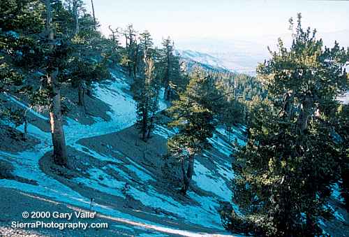
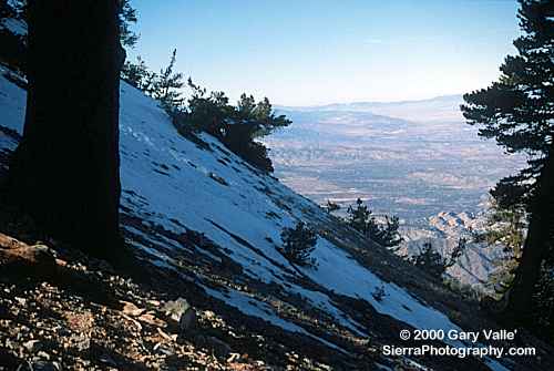 Snow on Mt. Baden-Powell |
Weathernotes for Tuesday, December 19, 2000As pointed out by a NWS Los Angeles/Oxnard forecaster yesterday, it's been several weeks since Los Angeles has had more than 0.01 inch of rain. The last time was back on October 29 when 0.53 inch was recorded downtown at USC. The current outlook suggests the dry weather could continue through New Year's. With the warm weather and lack of rain you might not think there was any (natural) snow in Southern California, but on the north slopes of the higher peaks of the San Gabriel Mountains there is some. |
|
On Sunday at the 8500 ft. level of Mt. Baden-Powell (9399 ft.) there was patchy snow, and at the 9000 ft. level snow and ice covered sections of the trail. Because the trail is on a steep north slope it can be very treacherous when there is snow. It looks like the Southern Sierra will have another below average December snowpack. A statistical analysis of the past 30 years of snow data for two stations in the Kern River basin suggests that a below average December snowpack may precede a below average seasonal snowpack. See Early Season Snowpack and Seasonal Snowpack in the Upper Kern River Basin, 1970-1999. After illogically persisting with a "Normal" precipitation forecast for several days, the 6-10 day forecast issued 12/19/00 shows above average temperatures and below normal precipitation for Southern California. The CDC Week 2 Forecasts also show a below normal precipitation probability. More information concerning Southern California weather can be found using our WEATHER LINKS page. |
|
 HPC QPF Forecast Wed/Thu |
Weathernotes for Wednesday, December 13, 2000The latest computer models suggest the incoming system will move through further to the north than forecast yesterday, with no significant precipitation expected in Southern California tonight or tomorrow. The HPC QPF forecast, issued this afternoon for the 24 hour period ending Thursday afternoon, shows paltry amounts of 0.01 inch along the central coast and Southern Sierra. Satellite photos show a jet on the back side of the trough digging southward, so maybe precipitation amounts will be slightly higher We'll see!. |
|
The 6-10 day forecast for Southern California issued 12/13/00 is for above average temperatures and normal precipitation. More information concerning Southern California weather can be found using our WEATHER LINKS page. |
|
 HPC QPF Forecast Wed/Thu |
Weathernotes for Tuesday, December 12, 2000Short term computer models, ensemble forecasts, and real-life weather forecasters suggest the Central and Southern Sierra should see its first significant snowfall in several weeks Wednesday afternoon into Thursday. The HPC QPF forecast, issued at 1931z 12/12/00 for the 24 hour period ending Thursday afternoon, shows amounts in excess of 1.0 inch liquid equivalent in topographically favored areas and in the forecast ending early Friday morning the precipitation extends into the Los Angeles basin. |
|
The HPC forecast may be somewhat optimistic with the system expected to move through the state relatively quickly and lesser amounts suggested by some models. We'll see! The 6-10 day forecast for Southern California issued 12/12/00 is for normal temperatures and normal precipitation. More information concerning Southern California weather can be found using our WEATHER LINKS page. |
|
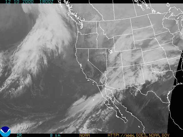 NOAA GOES-10 IR 1800z 12/10/00 |
Weathernotes for Monday, December 11, 2000As this satellite photo from yesterday morning shows, Southern California missed a chance for a little light rain when a weak upper level low continued its southward movement, taking most of the available dynamics and moisture with it. The last 28 days have been relatively dry in Southern California, and much of the west, so some rain would have been welcome. Intellicast radar shows another system moving onshore in Southern Oregon and Northern California. |
|
Current HPC QPF forecasts suggest precipitation from this first shortwave should be limited to the northern half of the state. A stronger system is expected to affect the state later Wednesday into Thursday, and could result in some snow in the Southern Sierra, and a chance of rain in Southern California. The 6-10 day forecast for Southern California issued 12/10/00 is for normal temperatures and normal precipitation. More information concerning Southern California weather can be found using our WEATHER LINKS page. |
|
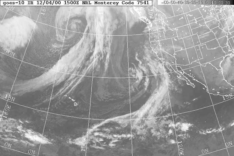 NRL GOES-10 IR 1500z 12/04/00 |
Weathernotes for Monday, December 4, 2000Last week there was much uncertainty in the computer models regarding the development of a trough or low along the west coast. A "Spaghetti" plot of ensemble forecast members for yesterday's 500mb heights showed a number of possible solutions and with some of these solutions, there would have been a chance of rain in the first half of this week. Today's IR satellite photo shows that a cut-off low has formed well off shore and HPC and ensemble forecasts suggest there will be no precipitation in Southern California until (perhaps) Wednesday or Thursday. |
|
So which computer model did the best job of forecasting the development of the upper low? Looks like the ECMWF gets the gold star. The day 5 verification plot for the ECMWF more closely matches what has actually occurred, than the day 5 verification plot for the MRF. This is also reflected in the anomaly correlations from the Global Modeling Branch. Current ensemble forecasts suggest unsettled and possibly wetter weather over the northern two-thirds of the state for the 6-10 day and "Week 2" periods. The 6-10 day forecast for Southern California issued 12/03/00 is for normal temperatures and normal precipitation. More information concerning Southern California weather can be found using our WEATHER LINKS page. |
|
