|
|
Sisquoc RiverHeath Camp to Tepusquet Rd. |
|
|
Sisquoc RiverHeath Camp to Tepusquet Rd. |
| IMAGES | |
|
(To enlarge an image, click on it. ) |
|
 |
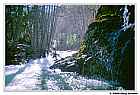
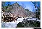
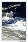
Kayak in snowstorm by headlamp light... This storm was the precursor to a storm that resulted in record levels on the nearby Cuyama River and very high water on the Sisquoc. |
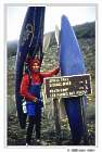 |
Only five more miles to go! |
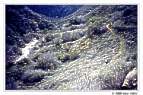 |
Switchbacking down to Judell Creek. The trail crossed Judell Creek several times. There was enough water in the creek that crossings were tedious; requiring that our kayaks be taken off and then put back on repeatedly. We could picture one of us falling in the swift water, and being swept downstream still attached to the boat with arms and legs flailing like some kind of giant upside-down insect. |
 |
Near the put-in at Heath Camp. We put on at about 8:45. |
 |
The flow was ideal for a exploratory descent. Adequate coverage, but not too pushy. |
 |
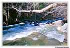
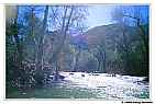
What a difference a week can make. Blue skies and sunshine instead of clouds, rain, melting snow and high water. |
 |
Located in California's San Rafael Wilderness, the Sisquoc River has been designated one of the nation's Wild and Scenic Rivers. |
 |
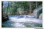
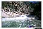
Some rapids were complex, with challenging moves and interesting solutions. |
 |
Plunking over a small ledge. Our heavily loaded boats punched little holes like this easily. |
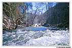 |
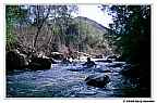
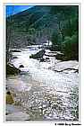
The first few miles of the Sisquoc River are moderately steep and continuous, with gradients in the 120-200 fpm range. |
 |
Drop below Cottonwood Camp, at about mile 1.4. It took about 1.5 hours to paddle the first mile to Cottonwood. |
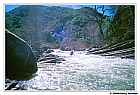 |
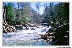
The river near the confluence of Rattlesnake Creek was particularly stunning. From upstream, the section looked like it might be very difficult. The warped layers of sedimentary rock resulted in some unique rapids. |
 |
Gary Gunder on a rapid we called "Hydroglyphics." One of the most aesthetic on the run, the multi-drop rapid ends with a sloping, diagonal, river-wide ledge. |
 |
The river upstream of Hydroglyphics. |
 |
Hydroglyphics from downstream. |
 |
It was a few minutes past noon when we rounded a corner, looked back, and saw Sisquoc Falls. If you look closely, there is a rocky formation extending down the ridge in the background. If you look even closer, and have a good imagination, you can see Sisquoc Falls. |
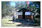 |
South Fork Guard Station is at about 6.5 miles into the run. It was only 1:30 when we got there, but it seemed as if we already had done at least a day's worth of rapids. From here there is another 40 miles of paddling! We were excited about getting to the Station because we wanted to say hello to Dominic, the Winter caretaker. As you can see the Station was absolutely ship-shape. The flag was up and everything was in perfect order. Some of his gear was out drying in the sun, but Dominic was no where to be found. |
 |
Manzana Schoolhouse. A must see landmark at the confluence of Manzana Creek and the Sisquoc River. |
|
More Sisquoc images will be added ... |
|